The National Trust and the Environment Agency are working to improve flood resilience and create better habitats for nature in the Ullswater Valley.
The £680,000 project at Goldrill Beck, near Hartsop, will see a stretch of river moved from its current course alongside a main road and re-meandered, creating a series of bends and smaller channels that will slow the flow of water and reduce the risk of flooding to key infrastructure.
Work to create the new river channel began in April, and with the river ready to be connected to its new course, the Trust must remove fish from the existing river channel to allow contractors to move machinery into the river and complete the final stages of the re-meandering.
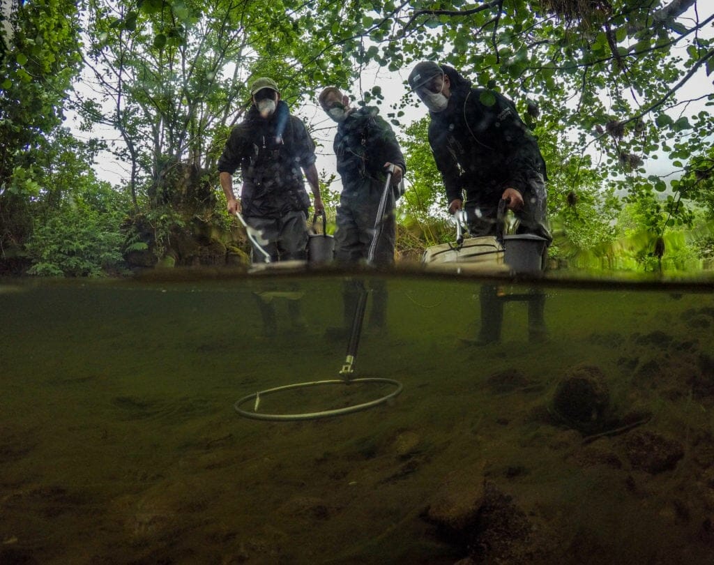
Working with the Environment Agency, community groups and volunteers, nets were used to restrict fish movement in and out of an 800m stretch of river above and below the section where in-river works will take place.
The Environment Agency used a process called ‘electro-fishing’ which involves passing a mild electrical current through the water to immobilise the fish. The fish were then moved by bucket to a stretch of the existing river on the other side of the net, as close to their original location as possible. Once the existing river channel is connected to the new course, the nets will be removed, and the fish will be able to move freely along their new river.
The process took place across four days, with National Trust staff, volunteers from partner organisations and local community volunteers helping to move the fish, including the river’s resident Atlantic salmon population to safety.

National Trust Riverlands project manager Rebecca Powell said: “Historic interventions in the Ullswater Valley have disconnected rivers from the surrounding landscape and resulted in channels which are highly efficient in transporting large volumes of water, gravel and natural materials downstream quickly. This then undermines defences and causes catastrophic damage to local infrastructure, farmland and local communities.
“We’ve been working with partners in Ullswater for decades to explore options for increasing flood resilience in the valley. The work we’re doing now to reconnect Goldrill Beck with the land that surrounds it and reinstate a more natural course will equip the river to manage the future impacts of climate change and extreme weather events.
“Over the last six weeks, our contractors have been creating new river channels in the valley bottom and connecting the river to these new channels requires us to carry out work in the water.
“Removing the fish from this section of the river will be a big undertaking, but with the support of community volunteers and our project partners, moving the fish safely upstream will allow us to compete this vital next stage of the project.”
The Evironment Agency and National Trust say the project will improve habitats for wildlife and slow the flow of water downstream.
Huge benefits for flood resilience and wildlife
Oliver Southgate, the Environment Agency’s river restoration manager for Cumbria, said: “Delivering river restoration work can provide a wide range of benefits not only for wildlife but also for contributing to natural flood management. This makes a real, positive difference to people’s lives and to communities as a whole.”
Led by the Riverlands project, a partnership between the National Trust and the Environment Agency, the project aims to reverse historic changes to Goldrill Beck which runs adjacent to the A592.
These changes artificially straightened the river channel, meaning it responds quickly to rainfall and carries large volumes of silt and debris downstream, eroding river banks along the way. This includes continually eroding and undercutting the A592 putting the key access route at risk.
During the course of the six-month project, 1.8km of the beck will be restored through a combination of re-meandering and embankment removal.
Beck moved away from its current course
The beck will be moved away from its current course, adjacent to the A592, running instead through the lowest point of the valley bottom where a series of bends will be reinstated.
This will be coupled with a series of embankment removals along the beck edge down to Menneting Bridge. This will restore a natural flooding regime across the land, allowing more water to be absorbed by the landscape, restoring traditional floodplain habitats, improving biodiversity and slowing the flow of water downstream during flood events.
Working with farm tenants, the trust also hopes to restore wetland habitats as part of the project including lowland fen and wet woodland which provide a home for a variety of breeding waders, reptiles and other wildlife.
The National Trust hopes that as coronavirus restrictions ease there will be opportunities for local communities to get close to the work on the ground, including site tours, volunteering days and school visits.
As well as installing signage to keep residents and visitors up to date with the project work, the trust has installed photo posts at various points around the valley to encourage people to take photos and share them using a dedicated hashtag, building up an image-based record of the changes across the site over the coming years.
Anyone interested in finding out more, or wanting to follow the progress of the project should visit www.nationaltrust.org.uk/aira-force-and-ullswater/projects/restoring-ullswaters-rivers


